Google Street View showcases Oakland University's campus
Forget a bird’s eye view - individuals from across the globe can now get peak at Oakland University from the ground floor, thanks to Google Street View.
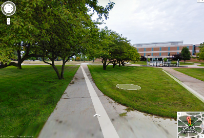
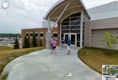
The Street View feature of Google Maps allows viewers to explore locations throughout the world, utilizing 360 degree street level imagery, showcasing areas of public interest, such as universities.
OU was offered a highly-coveted place in the Street View Partner Program. Other universities that received this coverage include San Diego State University, Cornell, Penn State, and Penn State Stadium.
Typically, the Street View imagery is collected from a vehicle, but in OU’s case, a human powered bicycle was outfitted with a camera, creating a unique look at the roads, paths, and trails around campus.
Soon, the Street View feature will be fully integrated into Oakland’s website, which will enable users to tour and explore the campus virtually from anywhere in the world in Google Maps and Google Earth.
Out of town, out of state, or international visitors will be able to utilize this program in a variety of ways, from campus touring to finding classes, parking and much more.
For now, Oakland’s Street View can be viewed by searching for Oakland University on Google Maps, and dragging the figure icon to a location on campus. Click here to see more.
Forget a bird’s eye view - individuals from across the globe can now get peak at Oakland University from the ground floor, thanks to Google Street View.
Created by Katherine Land - Deleted (land@oakland.edu) on Tuesday, December 13, 2011 Modified by Katherine Land - Deleted (land@oakland.edu) on Tuesday, December 13, 2011 Article Start Date: Tuesday, December 13, 2011